Lordosa parish council
- Parish council chair: José Manuel Pereira
- Address: Largo da Junta, n.º 1, Bigas, 3515-772 Lordosa
- Office hours: Monday to Friday, 9:00-13:00.
- Executive hours: Thursday, 18:30-20:00.
Find the school in Bigas, lines 16 and 17 and the pharmacy.

Chair, address, opening hours and contacts for certificates and voter registration.
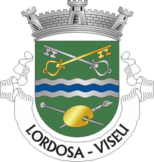
Contacts and opening hours published by Viseu City Council and by the the parish council’s official website. Chair elected in the October 2025 local elections. Confirm before you travel. Coat of arms: Sérgio Horta, CC BY-SA, Wikimedia Commons.
Choose what you are looking for to go to the right section.
The 16th most populous parish in the municipality, to the north: Bigas, Galifonge and Folgosa, about 11 km from the city.
The catalogue below only shows restaurants, cafés and supermarkets with a photograph in this polygon.
Bigas has primary education (years 1-4) and preschool; the Piaget campus in Galifonge offers vocational education. We have not confirmed a nursery in this parish. This list is not exhaustive; check current services with the parish council.
Line 16 stops in Paçô, Galifonge and at Instituto Piaget. Line 17 stops in Bigas, via Folgosa.
From the parish office, on Largo da Junta in Bigas, to Rossio.
Check a walking route before setting off. Distance and time depend on your starting point; check pavements, gradients and crossings. The driving estimate below does not describe the walking route.
About 11 km and 12 minutes, without traffic, south towards Rossio, on the EN2.
MUV Line 17 links Bigas to the Mobility Centre, via Folgosa. Line 16 links Galifonge and Instituto Piaget to the Hospital. Check direction and timetable before you leave.
Driving distance and time calculated from a real route (OSRM/OpenStreetMap) between the parish office, on Largo da Junta in Bigas (40.74273, −7.90445), and Rossio; approximate, not allowing for traffic. To compare parishes, we always use the parish office as the origin. Check the route before you leave.
The 16th most populous parish in the municipality, fifth in the rural territory, with its seat in Bigas and the Piaget campus in Galifonge.
What sets this parish apart from the other 24 in the municipality.
Lordosa has 1,642 inhabitants in 22.31 km². It is the fifth in the rural territory and the 16th in the municipality, north of the urban fabric.
It went from 1,791 inhabitants in 2011 to 1,642 in 2021. The parish council describes 14 villages. Density is 73.6 inhab./km².
The City Council marks it by the EN2, the Interior Way of St James and the Verde Gaio folk association. Line 17 stops in Bigas; Line 16 at Piaget.
Agrupamento de Escolas Viseu Norte has Escola Básica de Bigas in this polygon. Public 2nd and 3rd cycles are in Abraveses. The Instituto Piaget campus is in Galifonge.
Three cores to get your bearings, without covering the 14 villages one by one.
The parish office on Largo da Junta, the parish church, the primary school and the Line 17 stop on the EN2. The pharmacy is at Lugar do Casal, on the same road.
The Instituto Piaget campus on Estrada do Alto do Gaio, 3515-776. Line 16 stops in Paçô, Galifonge, Residências Piaget and Instituto Piaget. Lustosa is already Ribafeita.
The parish council places the Capela de Santo António da Serra here and says Folgosa includes the airfield. The Bombeiros Sapadores fire station, on Avenida do Aeródromo, falls within this area. The airfield terminal pin on OpenStreetMap falls in Abraveses.
Population and change: Statistics Portugal, 2011 and 2021 censuses. Area: CAOP 2025, Directorate-General for Territory. Characterisation: Viseu City Council and Parish council. Parish council: Nominatim, 40,74273, −7,90445. Accessed on 21 September 2026.
Pace, noise, traffic and services for anyone choosing a place to live.
In 22.31 km² live 1,642 people (73.6 inhab./km²). Between 2011 and 2021 it lost population (−8.3%). A rural parish to the north. The City Council describes it as host to those arriving by the regional air route and those walking the Caminho Interior de Santiago and the EN2. By day the pace is that of the villages. At night the calm is that of scattered settlement.
MUV Line 16 is called Lustosa/Piaget and stops in Paçô, Galifonge and Instituto Piaget. Line 17 is called Bairro Norad (via Folgosa/Bigas) and stops at Lordosa-Igreja and on the EN2 in Bigas. Lustosa-Escola is already in Ribafeita. Check stops and return times for appointments and shopping in the centre.
The City Council includes the municipal aerodrome, the Bombeiros Sapadores fire station and Instituto Piaget among the facilities that define this parish. The EN2 brings through traffic. The interior is rural.
The parish council is at Largo da Junta, no. 1, in Bigas. It is open Monday to Friday, 09:00-13:00, and the executive on Thursday, 18:30-20:00. There is no residents’ permit zone or shopping-centre car park. People park on the village streets.
The City Council highlights the Associação Folclórica Verde Gaio de Lordosa, a regular at the Marchas Populares de Viseu. There is no documented cluster of street bars. Ordinary nights are rural.
The parish council office is at Largo da Junta, no. 1. The hospital, Loja de Cidadão and tax office are in the parish of Viseu. Confirm the healthcare unit, branch and opening hours with ULS Viseu Dão-Lafões.
The City Council highlights the River Vouga, traditional chafurdo fountains, stone crosses and wayside shrines. Local leisure is this northern landscape, not an urban park.
The hospital, City Council, tax office and bus terminal are in the Parish of Viseu, to the south. The EN2 and the car cover that journey.
Editorial portrait of 13 September 2026. Population: INE, 2021 Census. Area: CAOP 2025, Direção-Geral do Território. Transport: MUV; municipal profile: Viseu City Council. Schools: DGAE, 2025/26 network. It is not a representative survey.
There is a pharmacy on the EN2, a CTT post point at the parish council and the Bombeiros Sapadores fire station on Avenida do Aeródromo. The parish council is at the top of the page.
On the EN2, between Bigas and Casal. Check the night-duty timetable at a city pharmacy.
Municipal professional fire brigade. The CTT service point operates at the parish council, Monday-Friday 09:00-13:00. Municipal documents mention a health clinic in Lordosa; check its current location and opening hours with the ULS health service.
Farmácia S. José: OpenStreetMap and Atlas da Saúde (EN2, Lugar do Casal, 3515-773); map pin 40,73516, −7,90827. Municipal fire brigade: Viseu City Council, Avenida do Aeródromo; map pin 40,72718, −7,89084. Each address was checked using a point-in-polygon test against the CAOP GeoJSON boundary for Lordosa on 21 September 2026. CTT service point: parish council, Largo da Junta, no. 1. Municipal documents mention a health clinic in Lordosa; mapping data cannot establish that services are absent.
1st cycle and preschool in Bigas and vocational education in Galifonge, confirmed in this polygon. No nursery in the parish Social Map.
Agrupamento de Escolas Viseu Norte, based at Escola Básica Dr. Azeredo Perdigão, in Abraveses. The parish council and the parents’ association describe the kindergarten and primary school joining in the same establishment. Escola Básica de Lustosa falls in Ribafeita, it does not belong on this page.
The 2nd and 3rd cycles of Escola Jean Piaget, in Vila Nova do Campo, are in the parish of Campo, not in this building. Check cycles and places with each institution.
No nursery is confirmed in this polygon on the Social Map. Care for ages 0-3 is in another parish. We do not copy a neighbour’s place.
There is no public 2nd cycle, 3rd cycle or secondary school in this parish. Agrupamento de Escolas Viseu Norte is based in Abraveses; public secondary (Viriato, Alves Martins, Emídio Navarro) is in the Parish of Viseu. Escola Jean Piaget in Vila Nova do Campo is another parish. Check catchment and places with each institution.
State school network: DGAE, “School Clusters and Independent Schools Network 2025/26” (confirm programmes and education stages for 2026/27 with the school cluster); schools belonging to Viseu Norte school cluster (EB Bigas, Rua da Capela, 3515-772, 232 912 494). Campus Piaget: Instituto Piaget and Escola Profissional Jean Piaget, Estrada do Alto do Gaio, 3515-776. Nursery: checked against Mapa Social no provision confirmed in this parish. Map pins: Nominatim EB Bigas 40,74412, −7,90686; official campus GPS coordinates 40,73675, −7,93933. Each address was checked using a point-in-polygon test against the CAOP GeoJSON boundary for Lordosa on 21 September 2026.
Line 16 links Galifonge and Piaget to the Hospital. Line 17 links Bigas to the Mobility Centre.
Stops at Paçô (Estrada Municipal), Galifonge, Residências Piaget and Instituto Piaget. Lustosa-Escola is already in Ribafeita. Check the direction and timetable before you set off.
The route lists Aeródromo, Sanguinhedo das Maçãs, Vilar, Vilarinho, Folgosa, Fermentelos, Lageosa, Quintãs and Lordosa-Igreja. On the EN2, it stops at Bigas Centro, Casal and Bigas. Bairro Norad is in Campo.
Since 1 September 2026, residents of the municipality aged 24 or over travel free on MUV within the municipality. The card costs €5. Young people up to and including age 23 use the free national pass.
Lines confirmed in the current municipal timetable. The Paçô, Galifonge, Instituto Piaget, Lordosa-Igreja and EN2-Bigas stops appear on the routes of lines 16 and 17. Lustosa-Escola falls in Ribafeita. Bairro Norad falls in Campo. We don't copy departures and frequencies: they change with the school term and network revisions.
Where to eat, the church in Bigas, the chapel in Folgosa and the bridge over the Vouga.
The highest rated on Google.
We do not yet have restaurants confirmed in this parish. Where to eat in the city
For a coffee or a cake in this parish.
We do not yet have cafés or cake shops confirmed in this parish. Where to eat in the city
Where to shop in this parish.
We do not yet have supermarkets, mini-markets or greengrocers confirmed in this parish. Supermarkets in the municipality
Church, chapel and bridge with a pin in the polygon. No filling station confirmed in this review. The aerodrome terminal, on OpenStreetMap, falls in Abraveses.
On Rua do Pombal, in Bigas, beside the parish office. It is this parish’s church.
On Rua de Santo António, in Fermentelos, beside Folgosa. São Bartolomeu is Folgosa’s patron, on 24 August. The Santo António da Serra feast is on 13 June.
The parish council points to a Roman bridge on the way from Galifonge to Paraduça, looking over the river Vouga. Pousa Maria, to the east, has a stretch of Roman road on the Interior Way of St James.
Igreja de Lordosa: Nominatim (40,74263, −7,90384). Capela de São Bartolomeu: Nominatim (40,73411, −7,89068). Ponte de Galifonge: parish council coordinates (40,75694, −7,93250). Pousa Maria: parish council coordinates (40,75333, −7,89639). Each map pin was checked against the CAOP boundary for Lordosa on 21 September 2026. The airfield terminal pin (40,72553, −7,88765) is in Abraveses, 245 m from the boundary. No petrol station has been confirmed within this boundary.
Two short notes before you leave home.
The parish council is open Monday to Friday, 09:00-13:00; the executive on Thursday, 18:30-20:00. The office is at Largo da Junta, no. 1, in Bigas. Counters and buses change hours on public holidays and school holidays. Always use the official link or the phone.
If a service has closed or a useful place is missing, tell us which one and give the source.
Last editorial review: 21 September 2026. This is an independent Olá Viseu page; it does not represent the parish council or the City Council.
See the transport, local services and walking guides too.
Population and 2011-2021 change from INE (2021 Census); boundaries from CAOP 2025; parish council, schools, transport and shops confirmed with Viseu City Council, the parish councils and Google Maps.