Parish of São João de Lourosa

Find schools, the Dão at Banho and the MUV lines.

residents
4 690
of the municipality
4,7%
density
180,4/km²
growth 2011-2021
−0,3%

The parish council

Chair, address, opening hours and contacts for certificates and voter registration.

Junta de Freguesia de São João de Lourosa

  • Parish council chair: Joel Marques
  • Address: Rua do Fasmo, 3500-899 São João de Lourosa
  • Office hours: Monday, Wednesday and Friday, 9:00-12:30 and 14:00-17:30. Tuesday and Thursday, 9:00-13:00 and 17:00-20:00.
  • Executive hours: Tuesday and Thursday, 19:00-20:00.

Contacts and opening hours published by Viseu City Council and by the the parish council’s official website. Chair elected in the October 2025 local elections. Confirm before you travel.

The parish in a few minutes

Choose what you are looking for to go to the right section.

Getting things done

Citizen Space at the parish council. The IEFP training service and CTT are at Parque Industrial de Coimbrões.

Getting around

Lines 12 and 21 serve Lourosa and Oliveira de Barreiros; Line 11 stops in Coimbrões and Cumieira.

Distance to the centre

From the parish office, on Rua do Fasmo, to Rossio.

On foot

Check a walking route before setting off. Distance and time depend on your starting point; check pavements, gradients and crossings. The driving estimate below does not describe the walking route.

By car

About 5.7 km and 8 minutes, without traffic, north towards Rossio.

By bus

Line 12 links Lourosa de Cima, Lourosa de Baixo and Oliveira de Barreiros to Rossio. Line 21 stops at Longra. Line 11 covers Coimbrões and Cumieira. Check direction and timetable before you leave.

Driving distance and time calculated on a real route (OSRM/OpenStreetMap) between the parish council office and the Rossio; approximate, without allowing for traffic. To compare parishes, we always use the parish council office as the starting point. Check the route before setting off.

The city’s southern ring

The seventh most populous parish in the municipality, with the river Dão at Banho.

Scale, change and identity

What sets this parish apart from the other 24 in the municipality.

The seventh most populous of the 25 parishes

São João de Lourosa has 4,690 residents in 26.00 km². It is the second of the peri-urban ring and the seventh in the municipality, south of the urban fabric.

Almost stable in the last decade

Between 2011 and 2021 it went from 4,702 to 4,690 residents, down 0.3%. It lost little, unlike several rural parishes in the municipality.

Vineyards inland, industry by the access roads

The City Council describes it as a birthplace parish of Dão wines. Industry sits by the access roads; inland it is vineyard and farmland.

The municipality’s only spa

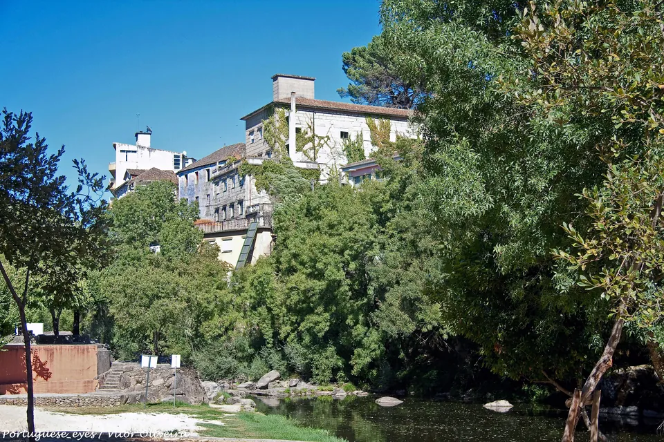
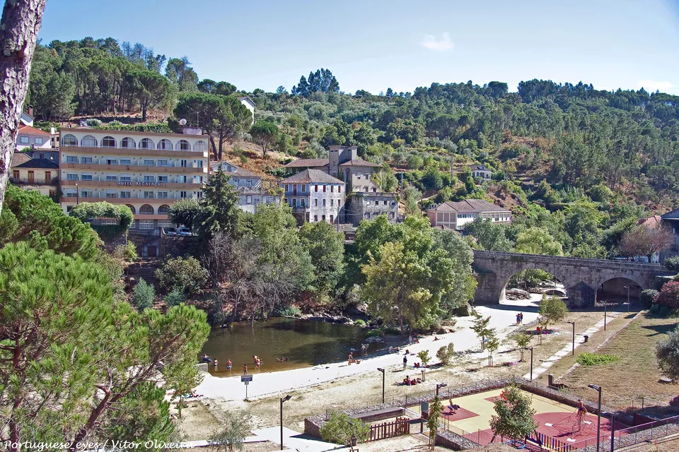
At Banho, on the right bank of the Dão, are the Termas de Alcafache, the only spa in the municipality of Viseu. The left bank is already Mangualde.

Areas within the parish

São João de Lourosa is made of several places, not a single centre.

São João de Lourosa

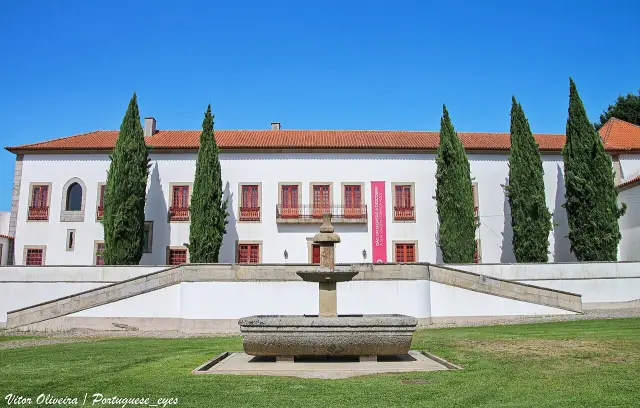
The parish office on Rua do Fasmo, the parish church and the primary school and kindergarten on Rua Principal, in Lourosa de Baixo.

Oliveira de Barreiros

The primary school and kindergarten, on ER 231-1. Not to be confused with the rural union of Barreiros e Cepões, to the north-east.

Teivas

Escola Básica de Teivas, on Travessa da Escola, and the Cavalhadas de Teivas, during the Santos Populares.

Coimbrões and Cumieira

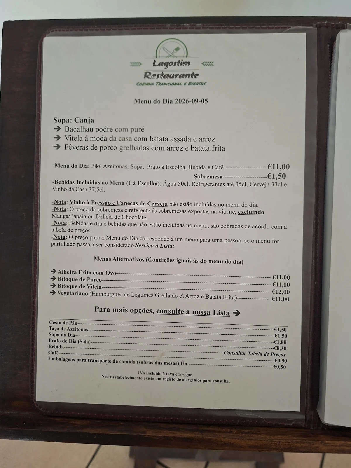
Parque Industrial de Coimbrões, the IEFP and Edifício Expobeiras, with CTT and the Lagostim restaurant. Line 11 stops in Coimbrões and Cumieira.

Rebordinho

The restaurant DeRaiz, at Rua da Capela, no. 13 (3500-898). It sits west of the parish seat, towards Vila Chã de Sá.

Banho

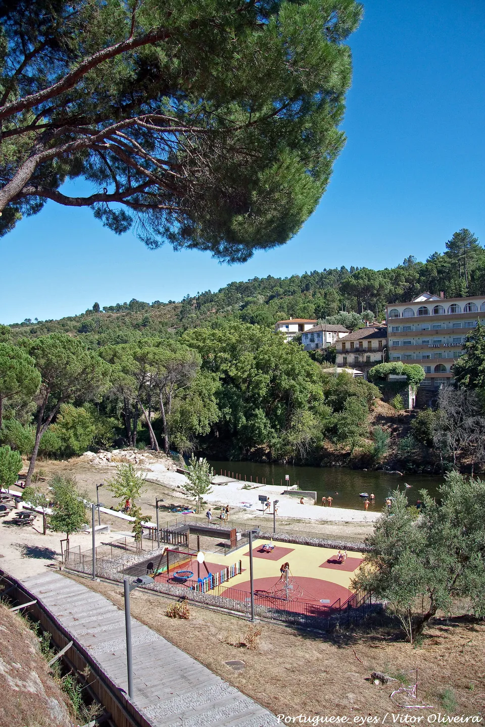
The Termas de Alcafache, the river beach and the park by the Dão, at the southern end. The left bank is already Mangualde.

Population and change: Statistics Portugal, 2011 and 2021 censuses. Area: CAOP 2025, Directorate-General for Territory. Characterisation: Viseu City Council. Areas confirmed through addresses already checked on this page. Accessed on 18 September 2026.

What it is like to live here

Pace, noise, traffic and services for anyone choosing a place to live.

Vineyards to the south, industry on the approaches

In 26.00 km² live 4,690 people (180.4 inhab./km²). Between 2011 and 2021 the population stayed almost stable (−0.3%). The City Council describes it as a birthplace parish of Dão wines: industry near the main access roads, farmland inland. By day people commute to the city, and there are schools in São João de Lourosa, Oliveira de Barreiros and Teivas. At night the pace is that of the villages, not of an urban centre.

Lines 11, 12 and 21 in the villages

MUV Lines 11 (Coimbrões), 12 (Oliveira de Barreiros) and 21 (Longra, towards Silgueiros) serve places in this parish, Oliveira de Barreiros is not Barreiros e Cepões. Since 1 September 2026, municipality residents aged 24 or over can travel free on MUV with the Passe Residente Viseu. For other journeys, compare the available timetables with your daily routine.

Industry on the approaches, farmland inside

The City Council concentrates industry near the main access roads. Inland is vineyards and farmland, with less traffic. There is none of the city's urban belt.

Village street parking

There is no permit zone or shopping-centre car park. You park on the street, near the parish council on Rua do Fasmo and near the villages' schools and chapels.

Cavalhadas in Teivas, village nights

The City Council highlights the Cavalhadas de Teivas, during the Santos Populares. For the rest of the year no cluster of bars is documented. Ordinary nights are those of the villages.

Citizen Space at the parish office

The parish council on Rua do Fasmo has an Espaço Cidadão public services desk. IEFP training facilities and CTT are in Parque Industrial de Coimbrões. The Employment Service is on Rua D. José da Cruz Moreira Pinto, plot 6. São João de Lourosa and Oliveira de Barreiros have preschools and primary schools, and Teivas has a primary school. The Paradinha primary school and preschool are in the neighbouring parish of Repeses e São Salvador. The hospital, Loja de Cidadão and tax office are in the parish of Viseu.

The Dão at Banho

The River Dão flows to the south, at Banho, with a riverside park, the City Council invites you to head down there. The vineyard landscape is the nearby leisure option inland in the parish.

The city sits north of the vineyards

The hospital, City Hall, tax office and bus terminal are in the Parish of Viseu, to the north. Lines 11, 12 and 21 and the car cover that daily trip.

Editorial portrait of 13 September 2026. Population: INE, 2021 Census. Area: CAOP 2025, Direção-Geral do Território. Transport: MUV; municipal profile: Viseu City Council. Schools: DGAE, 2025/26 network. It is not a representative survey.

Services close at hand

The IEFP training service and CTT post office are in Parque Industrial de Coimbrões. We have not confirmed a pharmacy in this parish. This list is not exhaustive; check current services with the parish council. The parish council and its Espaço Cidadão public service desk are listed at the top of this page.

Employment and training

IEFP: Viseu Vocational Training Service

IEFP's public training service in Viseu, in the Coimbrões industrial park. Apprenticeship courses and adult retraining. Job offers are handled at the Viseu Employment Service, on Rua D. José da Cruz Moreira Pinto.

Weekdays, 9:00-17:00. Check opening hours before you go.

Post office

CTT: counter at Expobeiras

A post-office counter in Edifício Expobeiras, in the Coimbrões industrial park, according to AIRV.

AIRV gives 9:00 to 13:00 and 14:00 to 17:00. Check opening hours before you go.

IEFP: Nominatim “IEFP Viseu, Parque Industrial de Coimbrões” (40,62862, −7,88510) and essential services. CTT: AIRV: Edifício Expobeiras (40,62972, −7,88318). Each map pin was checked against the CAOP boundary for São João de Lourosa on 18 September 2026. Pharmacy search on OpenStreetMap and Nominatim on the same date: no map points within the boundary. Espaço Cidadão public service desk: Viseu City Council, at the parish office.

Schools

Three public primary schools and two kindergartens, confirmed inside this polygon.

State network

Basic education: 1st cycle

  • Escola Básica de São João de Lourosa, Rua Principal, Lourosa de Baixo (Agrupamento de Escolas Infante D. Henrique)
  • Escola Básica de Oliveira de Barreiros, ER 231-1 (Agrupamento de Escolas Infante D. Henrique)
  • Escola Básica de Teivas, Travessa da Escola (Agrupamento de Escolas Infante D. Henrique)

There is no 2nd or 3rd cycle in the public network of this polygon. The grouping’s headquarters is in Repeses. Escola Básica and Jardim de Infância de Paradinha are in the neighbouring parish of Repeses e São Salvador.

State network

Nursery school

  • Jardim de Infância de São João de Lourosa, Rua Principal, Lourosa de Baixo (same building as the EB1)
  • Jardim de Infância de Oliveira de Barreiros, ER 231-1 (same cluster as the EB1)

The DGAE 2025/26 network does not list a public kindergarten in Teivas. No nursery (ages 0-3) is confirmed inside this polygon: in Portugal that age is a social response, not schooling.

Before choosing by proximity

There is no 2nd cycle, 3rd cycle or secondary school in this parish’s public network. The Agrupamento de Escolas Infante D. Henrique is based in Repeses; public secondary schools (Viriato, Alves Martins, Emídio Navarro) are in the Parish of Viseu. Confirm catchment and places with each institution.

State school network: DGAE, “School Clusters and Independent Schools Network 2025/26” (confirm programmes and education stages for 2026/27 with the school cluster); schools belonging to Agrupamento de Escolas Infante D. Henrique. Nursery search on Mapa Social and Nominatim on the same date: no map points within the boundary. Each address was checked using a point-in-polygon test against the CAOP GeoJSON boundary for São João de Lourosa on 18 September 2026. Check availability with each institution.

Buses and the link to the centre

Three MUV lines stop in this parish: 11, 12 and 21.

Line 12: Oliveira de Barreiros

It stops in Lourosa de Cima, Lourosa de Baixo and Oliveira de Barreiros, on the way to Rossio. Check direction and timetable before you leave.

Line 11: Coimbrões

It stops in Coimbrões and Cumieira, on the industrial-park axis. Check direction and timetable before you leave.

Line 21: Casal Meão

It stops in Oliveira de Barreiros (Longra), on the way to Silgueiros and Casal Meão. Check direction and timetable before you leave.

Free

Passe Residente Viseu

Since 1 September 2026, residents of the municipality aged 24 or over travel free on MUV within the municipality. The card costs €5. Young people up to and including age 23 use the free national pass.

Routes confirmed in the current municipal timetable. The stops Lourosa de Cima, Lourosa de Baixo, Oliveira de Barreiros, Oliveira de Barreiros (Longra), Coimbrões and Cumieira were checked against the CAOP boundary on 18 September 2026. Departure times and frequencies are not reproduced here: they vary with school terms and network updates.

Shops and leisure

Everyday shopping and the Dão at Banho, all inside the parish.

Popular restaurants

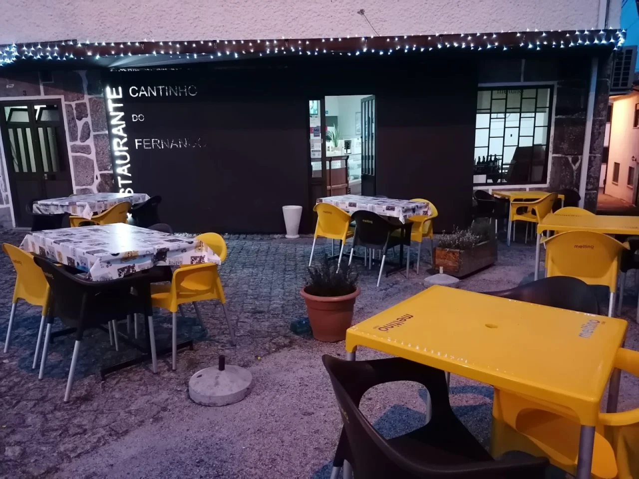
The highest rated on Google.

See all

Cafés and pastry shops

For a coffee or a cake in this parish.

We do not yet have cafés or cake shops confirmed in this parish. Where to eat in the city

Supermarkets, mini-markets and greengrocers

Where to shop in this parish.

We do not yet have supermarkets, mini-markets or greengrocers confirmed in this parish. Supermarkets in the municipality

Heritage and strolls

The spa at Banho, the river beach and the church at the parish seat.

Termas de Alcafache

The only spa in the municipality of Viseu, on the right bank of the Dão, at Banho. The left bank is already Mangualde. The City Council invites you down to the park by the water.

Banho river beach

A beach on the river Dão, with a park, a court and a bathing area. The river is the border with Mangualde here.

Parish church

Igreja de São João de Lourosa, on EM 593, between Lourosa de Cima and Lourosa de Baixo. The City Council notes religious heritage in each village; only this pin was checked against the polygon.

Thermal spa: Wikipédia: Termas de Alcafache and Viseu City Council. River beach: coordinates from Vitor Oliveira’s photographs on Wikimedia Commons. Church: OpenStreetMap. Each map pin was checked against the CAOP boundary for São João de Lourosa on 18 September 2026.

Before you set off

Two details that save unnecessary trips.

Check opening times

Counters and transport change their hours on public holidays, school holidays and festive seasons. Always use the official link or the phone.

Found something out of date?

If a service has closed or a useful place is missing, tell us which one and give the source.

Last editorial review: 18 September 2026. This is an independent Olá Viseu page; it does not represent the parish council or the City Council.

Continue discovering Viseu

See the transport, local services and walking guides too.

Where these facts come from

Population and 2011-2021 change from INE (2021 Census); boundaries from CAOP 2025; parish council, schools, transport and shops confirmed with Viseu City Council, the parish councils and Google Maps.

If you agree, we use Google Analytics to understand which guide pages are most useful. Learn more.